Collections » Utah - Moab 2008 » White Rim Trail Day 1 »
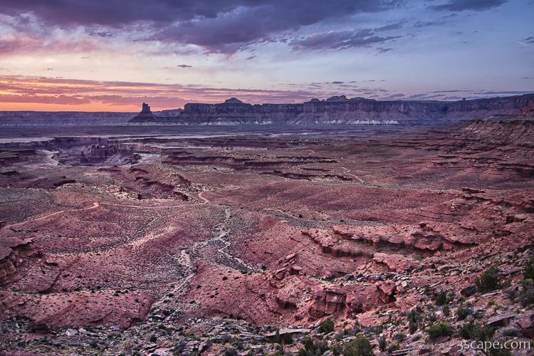
White Rim Trail Vista, Canyonlands National Park

Buy a Fine Art Print
The 100-mile White Rim Road loops around and below the Island in the Sky mesa top and provides expansive views of the surrounding area. Trips usually take two to three days by four-wheel-drive vehicle or three to four days by mountain bike.
The exposed geology of the Canyonlands area is complex and diverse; 12 formations are exposed in Canyonlands National Park that range in age from Pennsylvanian to Cretaceous. The oldest and perhaps most interesting was created from evaporites deposited from evaporating seawater. Various fossil-rich limestones, sandstones, and shales were deposited by advancing and retreating warm shallow seas through much of the remaining Paleozoic.
Eroded sediment from a nearby mountain range later mixed with coastal dune and sand bar deposits. The end of the Paleozoic and the start of the Mesozoic saw the last seas start to leave the region for good. A subdued topography was dominated by flood plains and tidal flats. Now much further inland, the Triassic climate in the region was dry. Vast deserts covered much of that part of North America, except for one period when streams for a time fought the sand dunes. Wetter times returned.
The uplift of the Rocky Mountains starting in late Cretaceous greatly affected the Canyonlands region. Erosion rates increased and further quickened upon the onset of the ice ages in the Pleistocene. Modern erosion occurs at a slower rate.


I take great pride in my images, so I want to make sure my customers are getting the highest quality products possible. My high resolution images are printed by some of the largest and most respected print fulfillment companies in the world, using professional grade printers on museum quality archival (acid-free) papers and canvases. Metal prints are printed on high gloss aluminum sheets, and are durable, light weight, and waterproof. Unframed prints ship in durable cardboard tubes, while framed and metal prints ship in flat boxes. Your professionally assembled custom fine art is usually ready to ship in 5-7 business days.
Just because you don't see it here, doesn't mean you can't have it the way you want it! I'm constantly adding new print options, frames, and mats. If you're looking for a particular frame or print material, custom size or crop, or even advice on what kind of print would look good in your space, just contact me, and I'll do my best to help you meet your needs.

Framed prints are professionally mounted and assembled by expert framing staff and arrive "ready-to-hang" with pre-attached hanging wire, mounting hooks, and nails. High-grade acrylic is used for glazing, which won't break in shipping. Frames are available to us at wholesale prices, which are typically 25-40% less than retail framing shops. If you're planning on framing a fine art print anyway, why not get it done professionally for less?

Add style and personality to any room with this fine art canvas print. Images are printed on premium canvas and mounted on 1.5" wooden stretcher bars. Wrap options include solid color (white or black), natural wrap, or mirrored wrap. Rolled canvas is an alternate option, and includes a 2.5" white border to allow for future mounting. Shipped to your door ready to hang, with pre-attached hanging wire or sawtooth hanger.

Hang a modern work of art on your wall, with these stylish metal prints. A high gloss finish adds depth and boldness to colors printed on a 1/16" thick sheet of aluminum. A hanging plate is attached to the back, to float the print 1/2"-3/4" from the wall, and rubber bumpers on all four corners stabilize the print when hung. These amazing lightweight prints are durable and even water proof!
Questions? Comments? Need stock or a photo shoot? Contact me!


